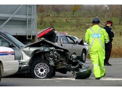
Many agencies are learning of the bennefit of Unmanned Aircraft for aerial based mapping for rapid aquisition of images for accident reconstruction. The systems can be deployed quickly and affordably and provide for precision placement of still imagery.
LIDAR
Infrared
Thermal
Digital Stills
HiDef and 4K resolution options


