


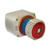


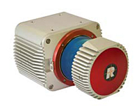
The RIEGL VUX-1UAV (former VUX-1) is a very lightweight and compact laser scanner, meeting the challenges of emerging survey solutions by UAS/UAV/RPAS, gyrocopter, and ultra-light aircraft, both in measurement performance as in system integration.
With regard to the specific restrictions and flight characteristics of UAS, the RIEGL VUX-1UAV is designed to be mounted in any orientation and even under limited weight and space conditions.
Modest in power consumption, the instrument requires only a single power supply. The entire data set of an acquisition campaign is stored onto an internal 240 GByte SSD and/or provided as real-time line scan data via the integrated LAN-TCP/IP interface.
Main Features:
10 mm survey-grade accuracy
Scan speed up to 200 scans / second
Measurement rate up to 500,000 meas./sec (@ 550 kHz PRR & 330° FOV)
Operating flight altitude up to more than 1,000 ft
Field of view up to 330° for practically unrestricted data acquisition
Regular point pattern, perfectly parallel scan lines
Cutting edge RIEGL technology providing
Echo signal digitization
online waveform processing
Multiple-time-around processing
Multiple target capability - practically unlimited number of targets echoes
Compact (227x180125 mm), lightweight (3.5 kg), and rugged
Easily mountable to professional UAS / UAV / RPAS
Mechanical and electrical interface for IMU mounting
Electrical interfaces for GPS data string and Sync Pulse (1PPS)
LAN-TCP/IP interface
Scan data storage on internal 240 GByte SSD Memory
Specifications:
10 mm survey grade accuracy
5 mm precision
Operating flight altitude up to more than 1,000 ft
Field of view up to 330°
3 m minimum range
Eye safe operation at Laser Class 1
Main dimensions: 227 mm x 180 mm x 125 mm
Weight: 3.5 kg (without cooling fan device) / 3.75 kg (with cooling fan device)
Main Applications:
Agriculture & forestry
Archaeology and cultural heritage documentation
Corridor Mapping: power line, railway track, and pipeline inspection
Topography in open-cast mining
Construction-site monitoring
Surveying of urban environments
Resource management