

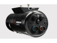
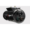


New to the market, the Routescene UAV LidarPod is a complete turnkey system developed specifically for use on Unmanned Aerial Vehicles (UAVs).
Survey industry expertise is behind the Routescene UAV LidarPod. We understand the problems you need to solve and have combined intelligent thinking with experience to design a reliable, practical and cost-effective solution. As a result the Routescene UAV LidarPod is a robustly engineered, self contained system. It is simple to operate and enables rapid deployment in the field. The turnkey solution includes LidarViewer, specially developed software to handle your resulting data.
What are the benefits?
The benefits of the Routescene UAV LidarPod are many and varied including:
saves time, generating more detailed and faster results
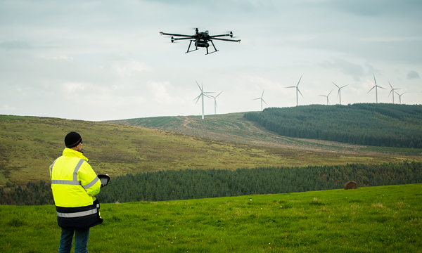
avoids exposure of personnel to awkward, dangerous and hostile environments
reduces time in the field and collects significantly more data compared to conventional survey techniques
collates accurate, detailed measurements from the air, which are more difficult to achieve with conventional surveying
achieves quicker results by collecting all the data needed in a single pass – much quicker than traditional methods
the higher density of data collected provides a much more detailed 3D view
collects data from different angles to minimize shadows
enables increased visibility in difficult to penetrate terrains such as forests
it is portable, lightweight and compact, suitable as flight hand luggage
independently CE and FCC certified to ensure compliance with electrical and radio transmission standards