

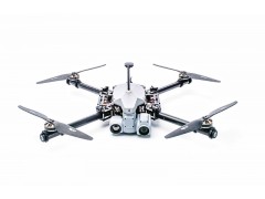
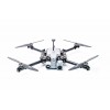


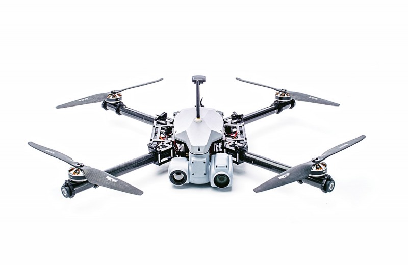
KX-4 MULTIROTOR
Description
KX-4 is a highly configurable and easy to assemble multirotor platform for survaillance, military and law enforcement missions.
KX-4 is a backpack-transportable and easy-to-assemble platform that provides georeferenced video and imagery. The man-portable solution makes it a perfect tool for small teams operating in remote areas without external support.
Users: Police SWAT, Border Patrols, Guard Units, Search & Rescue and First Responder Teams.
KEY ADVANTAGES:
- Lightweight, modular design
- Backpack-transportable
- Rapid deployment
- Fully autonomous or fly-by-camera flight modes
- Powerful and fully stabilized dual EO/IR gimbal
- HD video feed and on-board recording
Security
AES-256 encrypted telemetry, imagery and voice
Command and Control
Handheld or Mobile Ground Control Station
Interoperability
- Remote Video Terminal
- STANAG 4609 compliant KLV metadata
Technical details
Dimensions 85x85 cm
Weight MTOW 6,9 kg, payload capacity 1,5kg
Endurance 30-40 min
Optimal airspeed 6-12 m/s
Operationa ceiling 100- 200 m AGL
Flight readiness Less than 10 min
Standard payload
Dual EO/IR gimbal
EO sensor: 30x optical zoom, 720p HD
IR sensor: TAU2 640480, 35 mm or 60 mm lens
Optional: Laser rangefinder, IR illuminator, Laser designator
Features:
360 Degrees continuous pan, +10 … -100 depression angle
Gyro stabilized imagery
Geo-referenced images
Target tracking, Geo-locking
Moving Object Detection and Tracking
Comminication
4-5 km with Handheld Ground Control Station
Autopilot
Threod Systems autopilot
Automatic takeoff and landing, automatic navigation between predefined waypoints, real-time modification of waypoints, loiter modes, scan patterns, emergency contingency routes and landing areas.