Delivery Date:Within 3 days after your order is confirmed
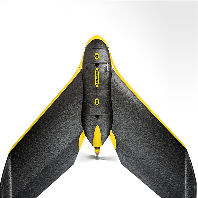
eBee
The professional mapping drone
Use this fully autonomous drone to capture high-resolution aerial photos that you can transform into accurate orthomosaics & 3D models.
4 reasons to choose the eBee
Map more, more accurately
The eBee can cover up to 12 km2 (4.6 mi2) in a single automated flight, while flights over smaller areas, flown at lower altitudes, can acquire images with a ground sampling distance (GSD) of down to 1.5 cm (0.6 in) per pixel.
No flying skills required
The eBee is the easiest to use professional drone on the market, used by thousands of customers around the world. To launch it, just throw the eBee into the air! It then flies, captures images and lands itself. However you can always alter its flight plan or land manually if required.
Because safety matters
Thanks to its ultra-light construction the eBee weighs just 700 g (1.5 lb), vastly minimising its impact energy. It also features a safety-conscious rear-facing propeller and senseFly’s cutting-edge autopilot, which manages a wide range of intelligent failsafe behaviours.
Your complete solution
The eBee package contains all you need to start mapping: a high-res RGB camera, batteries, radio modem and eMotion, our highly acclaimed flight planning and control software. Then just process and analyse the eBee’s images using professional image processing software, such as Pix4Dmapper.