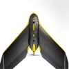
eBee The professional mapping drone eBee The professional mapping drone Use this fully autonomous drone to capture high-resolution aerial photos that you ca
2016-06-08
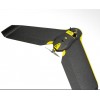
eBee Ag The precision agriculture drone eBee Ag The precision agriculture drone The eBee Ag is the only precision farming UAV you need. With its full drone-to-t
2016-06-08
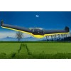
eBee RTK The survey-grade mapping drone eBee RTK The survey-grade mapping drone Capture aerial photography to produce orthomosaics3D models with absolute accura

 Product Categories