After "may have 'drops dozen aircraft," play "drone", the 20th China remote sensing convention in 10 uav remote sensing points on the BBS, aircraft owners and pilots association of China (China AOPA) executive secretary KeYuBao words put the audience laughing.Now, he explained, some unmanned aerial vehicle (uav) flight demand, but the lack of qualified drivers, some qualified can drive unmanned aerial vehicle (UAV), but you can not live, later AOPA may provide such a platform, similar to the drops a taxi.
"Fly hand" management regulations or at the end of the year
In June this year, China civil aviation flight standards department issued a "civilian drone pilot management interim provisions" draft, to some extent this represents the unmanned aerial vehicle (uav) industry development towards the direction of the specification, however, paper also cause much discussed within the industry."Fastest issued official documents at the end of this year. Civil unmanned aerial vehicle (uav) production and application more widely, has been in the field of uav remote sensing application, it will need to file specification industry development".KeYuBao said.
"A concept of unmanned aerial vehicle (uav) pilot head is for unmanned aerial vehicle (uav) rules of fly, can't literally flies", KeYuBao said, aviation culture common to preach, air traffic have rules to follow, the industry can be healthy and orderly development.
Professional unmanned aerial vehicle (uav) is a piece of blue ocean
In the 20th China remote sensing assembly at the opening ceremony, CST (shenzhen) satellite remote sensing application research innovation was unveiled, formally entered the shenzhen zhongke remote sensing industry.Zhongke told reporters the relevant person in charge of remote sensing, remote sensing (RS) industry, space information industry (GIS) and global positioning (GPS) service industry related to infiltration and common development, supporting the national spatial information infrastructure, in the military fields such as forestry, ecological environment, and play an important role, the remote sensing satellite also gradually into the life of the masses.
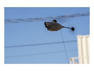
In addition to using satellite remote sensing data, division of remote sensing in unmanned aerial vehicle (uav), the independent research and development more than fixed wing, rotor unmanned aerial vehicle (uav) and uav remote sensing monitoring, and many times to participate in the emergency project.On the uav remote sensing points BBS, vice general manager, division of remote sensing science and technology group uavs lisa said, as the domestic part of the increasingly serious air pollution in cities, people growing demand for environmental monitoring and management, the uav remote sensing technology in the field of professional game, it can carry out inspection, supervision and law enforcement of the "full service".
"Unmanned aerial vehicle (uav) is the platform to get the data, remote sensing technology, we have to do is the organic combination of both. Consumption level in the development of unmanned aerial vehicle (uav) in shenzhen is very good, it is a piece of blue ocean before, I think professional unmanned aerial vehicle (uav) will become the new blue ocean".Lisa said.