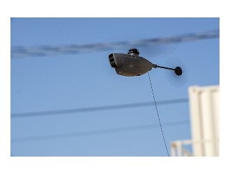
Boeing’s unmanned aircraft systems subsidiary, Insitu, has partnered with FireWhat and Esri to provide aerial reconnaissance for wildfire fighting, Insitu said. Reconnaissance missions would be done with Insitu airframes, including the ScanEagle; the company’s Inexa Control; and payloads, including high-accuracy photogrammetry.
The Inexa Solutions aerial remote sensing services group will work with FireWhat, Insitu said, using its geographic information system, customized for firefighters. The system is hosted on Esri’s ArcGIS platform.
"This is a revolutionary breakthrough in firefighting, as the typical 12-to-24 hours of critical information lag time during darkness or in smokey conditions is eliminated," said Jon Damush, VP and general manager of Insitu Commercial. "Combining INEXA Solutions' integrated imagery with FireWhat's solution that incorporates Esri's ArcGIS creates a 'best of breed' solution that will enable firefighters to quickly determine the best possible actions to take through GIS mapping."
Insitu said fire incident commanders currently have to work with fire line information that is often up to a day old. ScanEagle can fly at day and at night during the “gaps,” as Insitu said, to provide more current information. The drone would fly with infrared cameras for nighttime imaging, and with military-grade electro-optical cameras during the day.
The company said its imagery, coupled with FireWhat’s information system can provide near-real-time live, web-based video feed of thermal images to FireWhat’s ground-based mobile command centers. FireWhat data can create geo-referenced, high-resolution mosaics in PDF format and digital fire progression/suppression maps.
Insitu, FireWhat and Esri are also being supported by HP Inc.