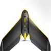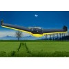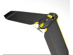
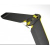
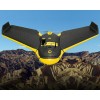


eBee RTK
The survey-grade mapping drone
Capture aerial photography to produce orthomosaics & 3D models with absolute accuracy of down to 3 cm - without Ground Control Points.
3 reasons to choose the eBee RTK
Survey-grade accuracy
Absolute orthomosaic / Digital Elevation Model accuracy of down to 3 cm (1.2 in) without the need for GCPs – meaning less time spent in the field and high precision in even the most inaccessible areas.
Fully integrated workflow
The eBee RTK’s supplied flight planning & control software (eMotion) connects to the base station and broadcasts correction data to the rover (eBee RTK) – no additional logger or third-party software required.
Compatible with existing base stations
The eBee RTK is compatible with most leading brands of base station, working seamlessly alongside your existing portfolio of instruments.