


SOLUTION DEscriptION
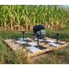
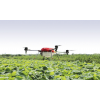
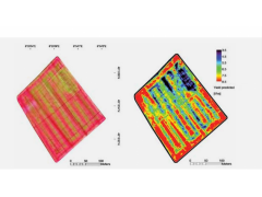
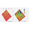
The BLY, equipped with high resolution cameras, thermal infrared sensors and multispectral cameras, acquires data that quickly processed generate the vigor maps essential to locate water-stressed areas, areas with poor fertilization, information useful for different treatment. wher the data acquired from the satellite do not guarantee the right resolution and the right acquisition rate, the DRONE is the best tool for Precision Farming.
AERMATICA collaborated with the Italian Research Council on Space4Agriproject for the development of innovative aerospace methodologies of Earth Observation to support the Agricultural Sector in Lombardy