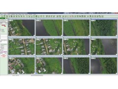


UAV Geomatics software is intended for processing of aerial images from the UAVs. The program processes images obtained from the professional and fixed lens digital cameras, attached to the UAVs.
End products of the UAV Geomatics and Geomatics Professional software are:
- photoschemes,
- photoplans,
- digital relief models,
- electronic maps and plans.
Ortophotoplans, electronic maps and digital relief models created with the software can be exported to formats GIS Panorama, AutoCAD, MapInfo, ArcGIS.