The Civil Air Patrol’s Florida Wing remained at “activation level” Sept. 4, 2016, following last week’s landfall of Hurricane Hermine. This was Day 10 on active alert for the wing.
Florida Wing operations is receiving tasking from FEMA Region IV, the state of Florida and the Air Force Rescue Coordination Center. The Area Command established under direction of CAP Lt. Col. Luis Garcia is coordinating activities at incident command posts located at Pensacola, Punta Gorda and Ormond Beach.
CAP’s Florida Wing provided more than 1,300 digital aerial images of Florida’s Gulf Coast to the Federal Emergency Management Agency (FEMA).
On Friday, Sept. 2, the first air sortie flew a route along the coast from Tallahassee to Crystal River and produced more than 600 images.
On Saturday, Sept. 3, a second aerial imagery sortie flew a coastal route from Punta Gorda to Crystal River. The flight lasted just under four hours.
“The typical summer afternoon weather pattern in Florida tends to create problems for aircrews,” said Maj. Richard Morrell, CAP aerial photographer. “However, our flight was beautiful.”

CAP photographers are providing both nadir-angle and oblique angle images.
Nadir refers to a specific vertical direction point below the aircraft. Nadir images are easier to assemble into a mosaic, while oblique angle images can provide greater information about structural damage, CAP officials explain.
“I was impressed by how much technology we were using in the small airplane,” said Morrell. “I was surrounded with boxes from the two camera systems and upfront the aircrew was using the GPS system with a pre-loaded flight plan. I’ve been doing this for a while and even I was impressed.”
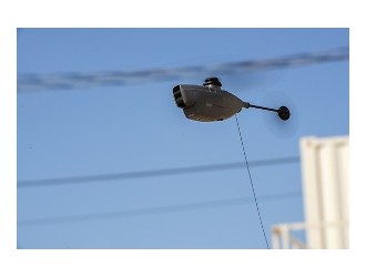
The wing-mounted VIRB camera system is the latest addition to CAP’s airborne imaging arsenal. The camera is remotely operated from inside the airplane using an electronic tablet. The camera provides the nadir-angle images at requested intervals.
Because the target is located directly under the aircraft, each member of the aircrew plays a distinct role. CAP’s professional volunteers complete specialized training to ensure a coordinated effort, officials noted.
In addition to the aerial imaging, the Air Force Rescue Coordination Center tasked Florida Wing with tracking down two emergency locator transmitter (ELT) beacon signals. The first request was received Sept. 3. An aircrew operating from the Ormond Beach ICP tracked the signal to the Cross City Airport. CAP ground team personnel were then deployed to the site to find the aircraft owner and silence the beacon. A second ELT was launched just after midnight today in the Fort Lauderdale area.
Civil Air Patrol, the official auxiliary of the U.S. Air Force, is a nonprofit organization with 56,000 members nationwide, operating a fleet of 550 aircraft. CAP, in its Air Force auxiliary role, performs about 90% of continental U.S. inland search and rescue missions and is credited by the Air Force Rescue Coordination Center with saving an average of 78 lives annually.
Its unpaid professionals also perform homeland security, disaster relief and drug interdiction missions at the request of federal, state and local agencies. The members also play a leading role in aerospace education and serve as mentors to 24,000 young people currently participating in the CAP cadet programs.