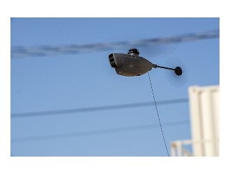
Drones are taking to the skies over the Otways to monitor planned burns and the region’s koala numbers as the State Government embraces the new technology.
A 12-week trial of the effectiveness of the aircraft for surveillance initiatives has been deemed a success, with the drones proving effective in remote areas of the region.
The government is now investigating an increase of the use of drones to improve its planned burn surveillance and other programs, such as the koala transfer initiative in the Great Otway National Park.
The drones have been surveying the results of the large-scale move of koalas from the overly-populated area of Cape Otway into a mixed-eucalypt forest in the national park.
It is part of a wider program, brought on by an abundance of koalas and a lack of food sources in Cape Otway, that includes fertility control and euthanisation measures.
Foliage in the manna gums has recovered since the relocation, with only 10 of the 259 koalas assessed in May found to be in poor health.
Environment and Climate Change Minister Lily D’Ambrosio said the state’s emergency department’s aviation fleet had almost doubled in the past 10 years, driving up demand for aerial intelligence gathering.
“With this technology, we can provide vital information to our firefighters and significantly improve our ability to survey areas that were previously inaccessible,” she said.
“We are taking an innovative digital-first approach and will use drones to help us better deliver effective environmental management for Victorians.”
The drones’ technology uses remotely sensed data, similar to that of a satellite, to source video and thermal imagery.
The Government has tested their capabilities in a variety of scenarios over a wider 12-month trial, looking at different types of drones and sensors.


